Bird's Eye View of the City of Stillwater
1870
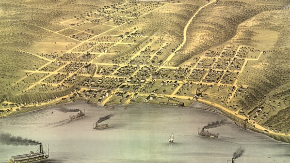
In November 1869, visiting artist Albert Ruger arrived in Stillwater, made a careful study of the area, and proceeded to draw a "Bird's Eye Map" capturing the growing river town. The Stillwater Republican examined the map and declared it "absolutely correct in every particular." Orders were accepted, and the final product was delivered in February 1870.
Ten years later, Ruger returned to a changed Stillwater and drew a new map.
Further Reading:
- Donald Empson, Guidebook to the 1870 and 1879 Bird's Eye Views of Stillwater, Minnesota (Stillwater, Minnesota: Empson Archives, 1996). Booklet and map reprints available from Washington County Historical Society.
- Library of Congress: "Panoramic Mapping" and "Panoramic Artists and Publishers"