1884 Sanborn Fire Insurance
1884
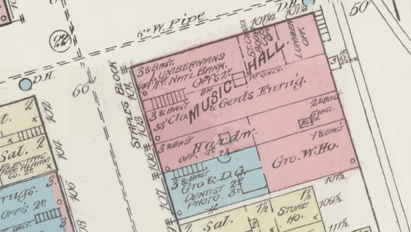
Sanborn Fire Insurance maps are some of the most valuable documents for Stillwater history research. They provide detailed information about the construction and use of buildings in much of Stillwater, including the downtown core.
This 1884 map is the earliest available fire insurance map for Stillwater.
The Sanborn company and its competitors created these maps to provide insurance companies with information they needed to evaluate fire risks. For this reason, they contain significant information about building materials as well as business operations.
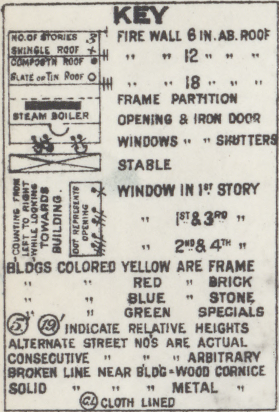
Here is the map key provided for the 1884 Stillwater map:
Library of Congress