Stillwater Map from Andreas Atlas
1874
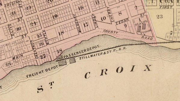
This map was one page in W.T. Andreas' An illustrated historical atlas of the state of Minnesota. It was published in 1874 and reflects one of the most significant changes in Stillwater's 19th century history: the arrival of two railroads.
The Stillwater and St. Paul Railroad arrived in 1871, entering Stillwater from the north along what is now the Brown's Creek State Trail. It was built on trestles over the water, but the shoreline subsequently moved far to its east.
The St. Paul, Stillwater, and Taylor's Falls Railroad arrived in 1872, entering Stillwater from the south.
A horse racing track is located in the southwest corner of the map.
Read more: Ristow, Walter R. "W.T. Andreas and His Minnesota Atlas" (PDF). Minnesota History, Fall 1966.