20th Century Streetcars in Stillwater
1899–1932
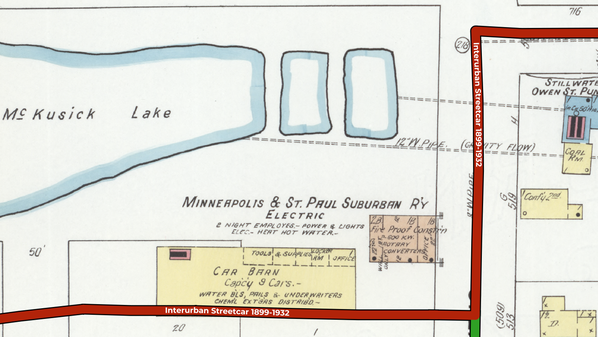
Stillwater's second streetcar system, a division of the Twin City Rapid Transit Company, began operations in 1899. This map overlays the street railway's routes with historic maps from 1878 and 1910.
Related:
Mobile Streetcar Route Tours on Lens Flare Stillwater - scroll down on homepage to find tours
Map Sources:
This map was created from various sources using GIS software.
Inside the city, routes are based on descriptions in Russell L. Olson, The Electric Railways of Minnesota (Hopkins, Minn.: Minnesota Transportation Museum, Inc., 1976). Outside the city (west of Owens Street), routes are based on 1938 aerial photos taken after the line was abandoned, but still clearly visible.
Detailed building maps in central city: 1910 Sanborn Fire Insurance Map of Stillwater.
Block and lot maps in remainder of city: 1878 Perfected Plat of Stillwater. (By the time of the street railway's completion in 1886, some of the undeveloped land on this 1878 map would have been subdivided into additional streets and neighborhoods.)